Site plan
Contents |
[edit] What is a site plan?
A site plan is typically a large scale drawing that shows the full extent of the site for an existing or proposed development. Site plans, along with location plans, may be necessary for planning applications. In most cases, site plans will be drawn up following a series of desk-based studies and site investigations.
See also: Location plan.
[edit] What scale should a site plan be?
Depending on the size and complexity of the project, site plans are likely to be at a scale of 1:500 or 1:200. However, for very small projects, larger scales may be used, and for large projects smaller scales, or even several drawings may be required, perhaps pulled together on one very small scale plan.
[edit] What should a site plan include?
The information shown on a site plan will vary depending on the nature of the project, however, certain key information is likely to appear on most site plans:
- Title block, giving the project name, drawing type, author, revision number, status, date, the scale used, and so on.
- Notes highlighting changes from previous revisions.
- Directional orientation. This could be a compass or a north-pointing arrow.
- Key dimensions.
- Key materials.
- Site boundaries and delineation of adjacent properties, including where necessary, adjoining or adjacent structures, and surrounding streets.
- The location of the building, buildings or other built assets (such as bridges, tunnels and so on) in relation to their surroundings.
- Trees, tree protection orders, and the main elements of the landscape.
- Parking areas with dimensions or capacities, traffic flows, and signage.
- Roads, footpaths, ramps, paved areas, and so on.
- Easements such as right-of-ways, right of support, and so on.
- Buildings to be demolished or removed.
- The general extent of earthworks, including, cutting and filling, the provision of retaining walls, and so on.
- The general layout of external services, including drainage, water, gas, electricity, telephone, manhole covers, and so on.
- The layout of external lighting.
- Fencing, walls and gates.
- The location of miscellaneous external components such as; bollards, fire hydrants, signage, litter bins, and so on.
Where the site is complex, some of this information might be shown on additional specialist site plans, such as; structural site plans, site history, site lines, services site plans, landscape drawings, access and traffic flows, ground conditions and geology, and so on. Site plans may be accompanied by site sections, showing the topography of the site.
With the adoption of building information modelling (BIM), site plans are likely to form an integral part of the project information model and may be prepared in 3D, perhaps based on a point cloud survey or as light detection and ranging (LIDAR, a combination of the words ‘light’ and ‘radar’).
Site plans might be prepared for both the existing site and the proposed site, and sometimes for intermediate stages if the development is to be phased, or where it is necessary to show information about the phasing of construction works.
See also: Site layout plan for construction.
[edit] Related articles on Designing Buildings
- 3D laser survey.
- As-built drawings and record drawings.
- Block plan.
- Concept drawing.
- Condition survey.
- Development appraisal.
- Elevations.
- Ground conditions.
- Laser scanning.
- Levelling.
- Location plan.
- Pre-construction information.
- Scale drawing.
- Site appraisals.
- Site information.
- Site layout plan for construction.
- Site survey.
- Soil survey.
- Surveyor.
- Types of drawings for building design.
[edit] External references
Featured articles and news
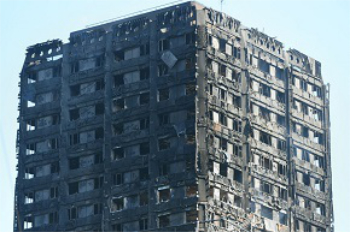
Grenfell Tower Principal Contractor Award notice
Tower repair and maintenance contractor announced as demolition contractor.
Passivhaus social homes benefit from heat pump service
Sixteen new homes designed and built to achieve Passivhaus constructed in Dumfries & Galloway.
CABE Publishes Results of 2025 Building Control Survey
Concern over lack of understanding of how roles have changed since the introduction of the BSA 2022.
British Architectural Sculpture 1851-1951
A rich heritage of decorative and figurative sculpture. Book review.
A programme to tackle the lack of diversity.
Independent Building Control review panel
Five members of the newly established, Grenfell Tower Inquiry recommended, panel appointed.
Welsh Recharging Electrical Skills Charter progresses
ECA progressing on the ‘asks’ of the Recharging Electrical Skills Charter at the Senedd in Wales.
A brief history from 1890s to 2020s.
CIOB and CORBON combine forces
To elevate professional standards in Nigeria’s construction industry.
Amendment to the GB Energy Bill welcomed by ECA
Move prevents nationally-owned energy company from investing in solar panels produced by modern slavery.
Gregor Harvie argues that AI is state-sanctioned theft of IP.
Heat pumps, vehicle chargers and heating appliances must be sold with smart functionality.
Experimental AI housing target help for councils
Experimental AI could help councils meet housing targets by digitising records.
New-style degrees set for reformed ARB accreditation
Following the ARB Tomorrow's Architects competency outcomes for Architects.
BSRIA Occupant Wellbeing survey BOW
Occupant satisfaction and wellbeing tool inc. physical environment, indoor facilities, functionality and accessibility.
Preserving, waterproofing and decorating buildings.







Comments
[edit] To make a comment about this article, click 'Add a comment' above. Separate your comments from any existing comments by inserting a horizontal line.
Great explanation on what is Site plan.